Trails / Alpena County
Open
An urban jewel built by the City of Alpena — about 14 paved, nearly flat miles of loops and spurs along Lake Huron and the Thunder Bay River.
Map & Directions
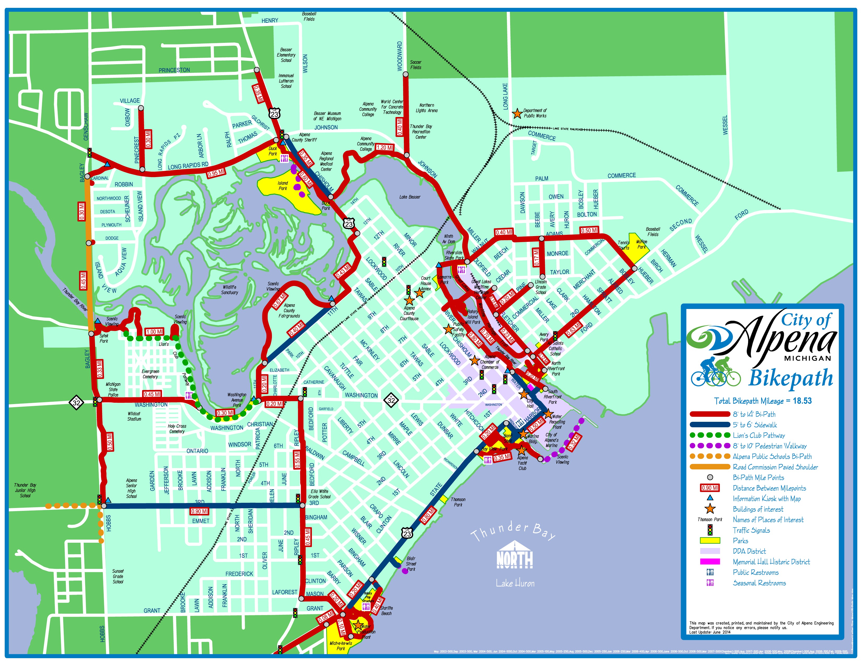
The Bi-Path is one great loop with several spurs and connections linking parks, schools, and civic attractions across Alpena.
About the Trail
The Bi-Path is an urban jewel built by the City of Alpena. In addition to some nice cityscapes, it features pleasing scenery along Lake Huron and the Thunder Bay River. Almost flat, it is all paved and suitable for all uses, and is mostly dedicated. About 14 miles in length, it consists of one great loop and several spurs or connections that add potential distance and variety to the route.
Many civic attractions are linked together by the trail, including the Alpena Wildlife Sanctuary, Water Works Park, and Bayview Park. Parks and other amenities are conveniently spaced along the trail, and there are good opportunities for loop rides on local roads that come into or across the Bi-Path. Snowmobiles and horses are not permitted.
In 2007, the City began expansion of the Bi-Path into the northern part of town to connect parks, schools, and other attractions. Two extensions completed that fall run from North Riverfront Park along Fletcher Street to the NOAA Great Lakes Maritime Heritage Center, and along the Thunder Bay River from Ninth Avenue to the Bi-Path at Fletcher Street, including a bridge to Rotary Park. The trail also links to the unpaved Alpena to Hillman Trail.
Get Involved
Trails are built and maintained by volunteers and donors. Join us.